Governor touts benefits of McClellan-Kerr Navigation System as flooding prompts state of emergency
by June 10, 2021 2:54 pm 1,085 views
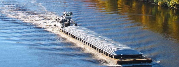
Arkansas’ top economic sector is agriculture and each year it creates tens of thousands of jobs and pours billions into the Natural State’s economy. One critical element of that continued success is flood control along the state’s many waterways and 50 years ago the McClellan-Kerr Arkansas River Navigation System (MKARNS) was created, in-part, to aid in this endeavor.
Gov. Asa Hutchinson, Arkansas Secretary of Commerce Mike Preston, members of the Arkansas Waterways Commission and others gathered in Little Rock on Thursday (June 10) to celebrate the half-century anniversary of the system as its importance was highlighted as the governor declared a flood emergency in the Arkansas Delta.
MKARNS is part of the U.S. inland waterway system originating at the Tulsa Port of Catoosa and running southeast through Oklahoma and Arkansas to the Mississippi River. The total length of the system is 445 miles. It cost $1.39 billion to build. It impacts 12 states, some as far away as Montana.
The benefits from MKARNS are incalculable, Preston said. Commerce moves along the system, hydroelectric power is created, tourists flock to fishing, swimming and other water features, and it provides irrigation for farmers throughout the region.
“I can’t stress what it means to our economy … if the river were to be shut down it would cost us $2 million per day,” Preston said.
Flood control is one of the primary impacts from the system. In recent days, heavy rains have pelted many parts of the state, especially the southeast section of the state in the Delta.
Hutchinson declared a state of emergency Thursday in response to recent flooding in southeast Arkansas. This declaration comes after over a foot of rain fell on some communities in a 24-hour period.
“After discussions with community members, local leaders, and the Division of Emergency Management, it quickly became clear that assistance is needed,” Hutchinson said. “Business owners, farmers, and everyone in the area are feeling the impact of this weather event, and we’re moving quickly to help however we can.”
The declaration will direct $100,000 from the Emergency Response Fund of the Governor’s Disaster Fund to be used at the discretion of the Director of the Division of Emergency Management.
Hutchinson said the next critical step in expanding the effectiveness of the river navigation system is to deepen the channel from nine to 12 feet. He noted that he has been promoting this idea since he was in Congress more than 20 years ago.
“It takes upkeep. It takes modernization,” he said.
The McClellan-Kerr Navigation System was named for two Senators, Robert S. Kerr (D-OK) and John L. McClellan (D-AR), who pushed its authorizing legislation through Congress.
The system officially opened on June 5, 1971. President Richard M. Nixon attended the opening ceremony.
It is operated by the Army Corps of Engineers. While the system primarily follows the Arkansas River, it also includes portions of the Verdigris River in Oklahoma, the White River in Arkansas, and the Arkansas Post Canal, a short canal named for the nearby Arkansas Post National Memorial which connects the Arkansas and White Rivers.
Through Oklahoma and Arkansas, dams artificially deepen and widen the modest-sized river to build it into a commercially navigable body of water. The design enables traffic to overcome an elevation difference of 420 feet (130 m) between the Mississippi River and the Tulsa Port of Catoosa. Along the section of the Arkansas River that carries the McClellan–Kerr channel, the river sustains commercial barge traffic and offers passenger and recreational use through a series of reservoirs.