Arkansas has its highest wildfire numbers in five years during 2017
by January 8, 2018 1:08 pm 845 views
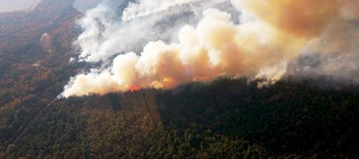
In 2017, 1,566 wildfires burned 27,549 acres in Arkansas. It’s the highest number of wildfires and acres burned since 2012 when 2,148 wildfires burned 34,434 acres.
Overall, wildfires were larger in 2017 with an average size of 17.6 acres compared to a 10-year average of 15.5 acres. The highest wildfire frequency month was November when 316 wildfires burned 5,858 acres.
The 2018 wildfire outlook, provided by the National Interagency Coordination Center, predicts higher than normal Arkansas wildfire activity from February through April in Northwest Arkansas counties based on predicted drought conditions and forecasts for dry air over the region. Find detailed outlook maps, here.
“2017 has been an active wildfire year, which points to the fact that we have a lot of woody debris on our forest floor,” said State Forester Joe Fox. “With plenty of fuel, an uncertain drought outlook, and wildfires trending larger in size, Arkansans can expect the possibility of an active wildfire season beginning soon. Wildfire danger can take place anytime when we have dry fuels, low humidity, and moderate wind. Forestry crews remain highly trained and well equipped. Residents should always be mindful of safe burning, but should use added caution in the coming year.”
Since 1935, the Agriculture Department’s Forestry Commission has archived annual wildfire statistics by frequency, cause, and county. Counties with the highest 2017 wildfire frequency were: Izard, Hot Spring, Saline, Searcy, Miller, Grant, Sharp, Fulton, Garland, White, and Conway.
The primary causes of Arkansas wildfires continue to be arson and unintentional wildfires caused by routine outdoor burning including the burning of trash, grass and leaves. Other causes of Arkansas wildfires include lightning strikes, children playing with matches, cigarettes, equipment, and campfires.
Arkansans have many ways to stay informed about Arkansas wildfire danger. Link here for maps featuring wildfire danger determined by the Arkansas Forestry Commission, Burn Bans declared by County Judges, and prescribed fires reported to the AFC Dispatch Center. Link here for fire weather forecasts are available from the National Weather Service in Little Rock.