Drone program to help monitor Arkansas forests
by July 14, 2022 3:48 pm 1,589 views
Dr. Hamdi Zurqani, assistant professor of geospatial science, joined the University of Arkansas-Monticello College of Forestry, Agriculture and Natural Resources (CFANR) in the fall of 2021. When he arrived on campus, he taught in classrooms and now he also works in the sky.
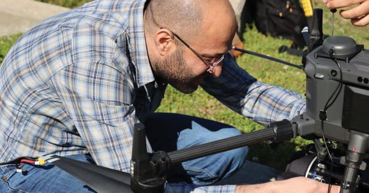
Zurqani can fly UAM’s DJI Matrice 300 RTX drone, a $60,000 tool the university plans to use in forestry studies. The goal is to assess conditions in the university’s 1,080-acre forest. The drone has a flight time of up to 55 minutes depending on whether it carries a payload. It has thermal, zoom, wide-angle and distance finder capabilities.
“Drones have recently become an essential tool for forest management and forest health monitoring,” he said. “So, we purchased this drone to help us get accurate data for every tree in our forests.”
Researchers hope to acquire a wealth of information and data points from the drone flights.
“This drone will be utilized to characterize key indicators of urban forest health and investigate statistical relationships between forest health, such as individual forest trees and species, and vegetation indices derived from the drone imagery,” said Zurqani. “It will also be utilized to calculate the trees’ heights and crown widths and use this information to calculate how much carbon is held in its above-ground biomass.”
Creating new tools to monitor and protect Arkansas’s forested lands will be critical in the years to come. The forestry sector is one of the largest in the state, producing billions of dollars in economic activity and creating nearly 65,000 jobs either directly or indirectly. The Arkansas Legislature formed a Forestry Caucus in April to help tackle issues connected to the industry.
“The creation of a forestry caucus within the Arkansas General Assembly has the potential to be one of the most important and effective tools I’ve seen in my more than 30 years in the timber and forest products sector,” said Max Braswell, executive vice president of the Arkansas Forestry Association at the time.
“Our ability to work together in Arkansas is known nationwide. The support and partnership of our legislative leaders will only enhance the multitude of opportunities we have to make working forests a ‘part of the solution’ — whether it’s as a natural climate solution, economic driver for rural communities or in keeping our natural state natural. These are exciting times and AFA fully supports the creation of a forestry caucus,” Braswell added.
That sentiment was echoed by Arkansas Farm Bureau President Rich Hillman.
“Our state’s forestry industry ranks third in the nation and annually contributes nearly $5 billion to the Arkansas economy, making it an incredibly important part of our agriculture portfolio. We look forward to working with policymakers to expand an industry so crucial to our state,” Hillman said.
The drone is equipped with sensors that can read visible light and near-infrared bands. It can be used to monitor and detect signs of stress, Zurqani said. The drone is also equipped with a LiDAR detection system. LiDAR — light detection and ranging — is a remote sensing method that uses a pulsed laser to measure range and generate precise 3-D data. The LiDAR system UAM purchased comes with eight lasers. The LiDAR software and data package can process and convert the measurements into maps and graphics.
Before Zurqani could use the drone and its data collection, he and three students trained in Alabama on the LiDAR system. Those students were AlSaket AlDaikh, Ricky Parris, and Katie Hickle. Zurqani had to be certified by the Federal Aviation Administration to fly the drone. Students will be tested and receive their remote pilot certificate issued by the FAA before being allowed to fly.
UAM had to build a base station for the drone, called the Global Navigation Satellite System, or GNSS. The GNSS receiver collects GPS measurements at a known location. GNSS receivers like those in smartphones can only determine the position with up to a four-meter accuracy, meaning that if you use your smartphone to navigate to a point you would be able to get within 10 to 13 feet of the point.
However, the UAM base station, which includes a GNSS correction technology, means “we could obtain high-precision positioning data at centimeter-level accuracy,” said Zurqani. Navigating using the UAM base station provides targeting to within an inch of the set point.
The use of drones for a variety of purposes has become more widespread and the technological capabilities of these tools has expanded rapidly. Officials at the university are thankful that Zurqani can fly the drone.
“Drone-based remote sensing is one of the fastest-developing suites of technologies, with high impacts on improving the accuracy and efficiency of managing natural resources and agricultural operations,” said CFANR Dean Michael Blazier.
“We’re very fortunate in our college to have a professor of Dr. Zurqani’s caliber to lead the way for us in this field. He has a robust research program underway for advancing the capabilities of drone-based remote sensing, and our graduate and undergraduate students benefit greatly from how he is incorporating his leading-edge work into the classroom,” Blazier added.