Feds to fund start of Arkansas River deepening work, ‘Three Rivers’ project
by March 31, 2022 5:29 pm 3,898 views

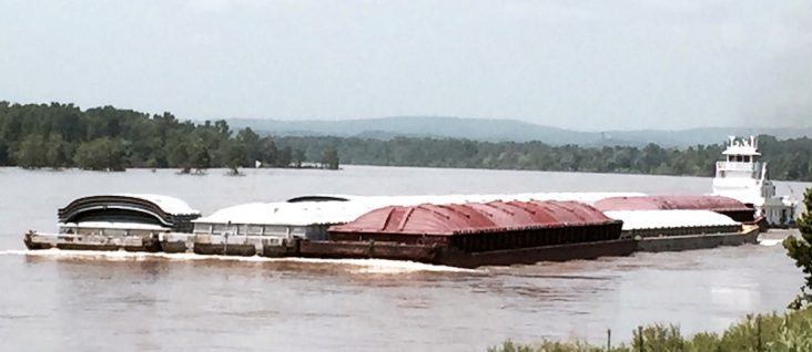
Funding from the federal Infrastructure Investment and Jobs Act (IIJA) has put the first significant funding in a decades-long effort to deepen the Arkansas River navigation channel to 12-feet. Much of the river system depth is now at nine feet.
On March 29, the U.S. Corps of Engineers (USACE) published an addendum of projects funded through IIJA, which included $92.6 million to “initiate construction of the project.” All six members of Arkansas’ Congressional delegation voted against the infrastructure bill.
The Arkansas River system (McClellan-Kerr Arkansas River Navigation system, or MKARNS) is 445 miles long and stretches from the confluence of the Mississippi River to the Port of Catoosa near Tulsa, Okla. The controlled waterway has 18 locks and dams, with 13 in Arkansas and five in Oklahoma. The river also has five ports: Pine Bluff, Little Rock, Fort Smith, Muskogee, Okla., and the Tulsa Port of Catoosa in Oklahoma.
A March 30 presentation by Greg Mattson, deputy chief of operations for the USACE Little Rock District, to the Arkansas Waterways Commission shows that that federal authorization of the channel was made in 2004, and the cost of that work is now estimated at $274.7 million. (Talk Business has attempted to contact Mattson to get clarification on the cost estimate, and when and where the work might begin.)
‘LIQUID HIGHWAY’
Phyllis Harden, chair of the Arkansas Waterways Commission, said much of the navigation channel is now at 12 feet or more, and the funding will help improve the river depth faster than industry officials previously believed. (Link here for USACE info on river depth info.) She said a deeper channel on all river segments could mean 40% or more placed in each barge.
“Putting 43% more in each barge will help industry, particularly, with fuel prices as high as they are. It really feels good for the MKARNS to finally be recognized as worthy of funding. It is a good day for the State of Arkansas and the waterways industry,” Harden told Talk Business & Politics. “As previous studies have indicated, the majority of the dredging is in Oklahoma. Dikes, mostly in the Arkansas portion, have helped achieve and maintain the current depth and hold it during high water.”
She praised past efforts of Sen. John Boozman, R-Ark., and U.S. Rep. Bruce Westerman, R-Hot Springs, in advocating for river funding.
Marty Shell, president of Van Buren-based Five Rivers Distribution, which operates the port of Fort Smith and a port facility in Van Buren, said river operators have been lobbying for such funding since 1998.
“The deepening of the system will allow the state to compete with Louisiana, Mississippi, Missouri, Tennessee, and Kentucky for job recruitment and retention. This will allow for 43% more product to be put into the same barge, and with the inflationary times and high fuel prices along with truck driver recruitment shortages and constraints, this improvement will reap benefits for the River Valley for years to come,” said Shell, who is also a member of the state’s Waterways Commission.
He also said better utilization of the state’s “liquid highway” which provides transportation needs for Arkansas’ agri, construction and manufacturing sectors, will have broad benefits.
“Barging is the most economical way to move a ton mile, and it is also the most environmentally friendly way to move a ton mile. It’s time for us to start utilizing our liquid highway more than we have in the past,” he said.
THREE RIVERS
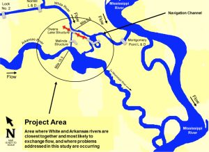
The IIJA addendum also includes $109.147 million for work on the “Three Rivers” project to control flooding and erosion near the confluence of the Arkansas and Mississippi Rivers. Without additional infrastructure, flooding could cause expensive and long-term disruptions on the Arkansas River system.

“More importantly, if a cutoff formed, navigation through the project area would cease for extended periods due to dangerous cross currents during high flows, and draft constraints during low flows until USACE could mobilize their contingency plan and repair or close the cutoff, which would take at least six months. During the closure, most shippers would have to find alternative overland routes at much higher costs. In addition, sediment deposition would increase dredging requirements, and an estimated 200 acres of bottomland hardwood forest in the path of a cutoff would be destroyed as land converted to open water,” the USACE noted in an April 2018 report on the project.
The USACE recommended a containment plan that in early 2018 was estimated to cost $187.651 million.
