National Geographic To Launch ‘Geotourism’ Project For The Mississippi River Corridor
by July 9, 2015 9:21 am 412 views

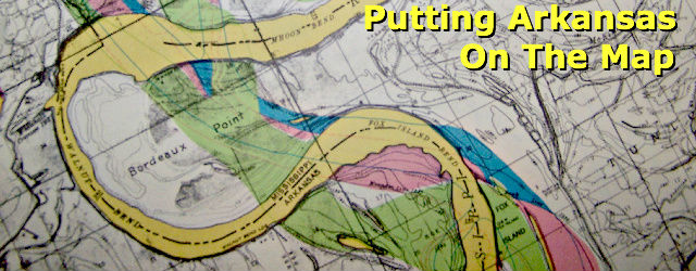
National Geographic Maps is looking for local input from Arkansas communities to highlight the natural and cultural attractions along the Mississippi River.
The project seeks to contribute to the economic health of communities by promoting geotourism: tourism that sustains or enhances the geographical character of a place — its environment, culture, aesthetics, heritage and the well-being of its residents.
Public forums and presentations will be conducted in communities in Arkansas on July 14, 15, 16, and 17 to encourage nominations and community involvement.
Paragould – July 14th, 1:00 p.m. – Paragould Chamber of Commerce, 300 West Court Street
Jonesboro – July 14th 7:00 p.m. – Arkansas State Museum
Blytheville – July 15th 10:00 a.m. Delta Gateway Museum, 210 Main Street
Osceola – July 15th 1:00 p.m., Chamber Civic Center, 116 N. Maple
Parkin – July 15th 6:00 p.m., Parkin Archeological State Park, Hwy 60, 184N
West Memphis – July 16th 9:00 a.m., MidSouth Community College, Marion Berry Building, Rm 136, 2000 West Broadway
Marianna – July 16th 1:00 p.m., Mississippi River State Park, 2955 State Hwy 44
Helena-West Helena – July 16th 7:00 p.m. Delta Cultural Center, 223 Cherry Street
Dumas – July 17th 9:00 a.m. City Hall, 124 W. 6th Street
McGehee, AR – 1:00 p.m. Municipal Building, 901 Holly Street
Lake Village – July 17th 5:00 p.m., Lakeport Plantation, 601 AR-142
A community-based nomination process is being used to create a National Geographic online interactive “Geotourism MapGuide” website for the region. The Mississippi River region designated for the map encompasses one county wide on either side of the River with the inclusion of the entire Delta region from Illinois south, communities, sense of place businesses, recreation facilities, plus private and public lands along the river in all ten states.
“Participation by local residents is critical to the project’s success,” said former Arkansas State Senator Steve Higginbotham. “Our goal is to get nominations from across the region that identify the things people love best, those ‘must see’ places that might range from an incredibly beautiful hike to an atmospheric downtown area with local character.”
Online Geotourism MapGuides have been published for the U.S. Gulf Coast States (Louisiana, Mississippi, Alabama, Florida), Bahamas, Newfoundland (Canada), Douro Valley (Portugal), Western Balkans (Albania, Bosnia-Herzogovina, Kosovo, Macedonia, Montenegro, Serbia), Bocas del Toro and Roatan, (Panama, Honduras), Central Cascades (Oregon, Washington), Crown of the Continent (Alberta, British Columbia, Montana), Four Corners (Arizona, Colorado, New Mexico, Utah) East Tennessee River Valley, Greater Yellowstone (Idaho, Montana, Wyoming), Lakes to Locks Passage (New York), Redwood Coast (California), Sierra Nevada (California).
“The National Geographic Maps Division is pleased to have the opportunity to spotlight this region and, in doing so, support and sustain it as one of the treasured natural places on the globe,” said James Dion, business development associate, National Geographic Maps. “The MapGuide website will celebrate the area’s abundant scenic, cultural and historical attributes from the unique vantage point of those who live there.”
National Geographic Maps was established as a division of the National Geographic Society in 1915 and has been producing maps for National Geographic magazine and other Society groups for 95 years. National Geographic Maps produces outdoor recreation mapping software, Trails Illustrated maps and software, globes, wall maps, travel maps and atlases. For more information on National Geographic Maps, visit natgeomaps.com.
