‘Catastrophic’ Flooding Could Hit Areas Of Arkansas In The Next Few Days
by October 21, 2015 8:20 pm 255 views

Editor’s note: This story includes information from AccuWeather.
Among those wishing for rainfall, well, get ready. AccuWeather is reporting that Arkansas and several other south central U.S. states could see “catastrophic flooding” beginning as early as Friday and continuing into early next week. The rainy weather prediction has an Arkansas River operator securing barges.
According to AccuWeather, persistent or slow-moving torrential rain could hit Arizona, New Mexico, Colorado, Texas, Oklahoma, Kansas, Arkansas and Louisiana. While the rain will aid some communities by marking an end to the wildfire risk, greening up lawns and grazing lands and replenishing water supplies, it will come at a price.
The risk of flooding and severe thunderstorms will continue to affect the deserts, southern Rockies and southern High Plains as a non-tropical storm pushes eastward through the Four Corners into Thursday.
ARKANSAS RIVER CONCERNS
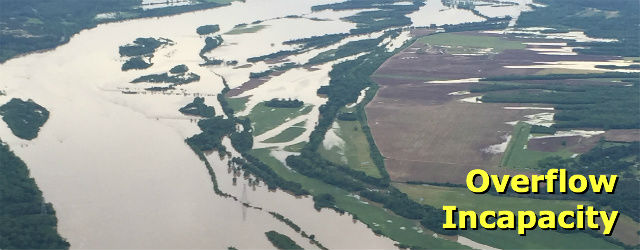
An unusually wet end of winter and spring season resulted in river flooding that shut down a majority of lock and dam operations, especially on the Arkansas River (McClellan-Kerr Arkansas River Navigation System). Just when the cycle of wet weather from the west was ending, Tropical Storm Bill moved out of the Gulf of Mexico and dropped more than 12 inches of rain during mid-June on many areas of Oklahoma, including Arkansas River watershed areas. According to the Corps, river flows from the spring rains reached 180,000 cubic feet per second, well above the typical 20,000 cubic feet per second.
The rains disrupted traffic on the river for six months. August tonnage on the Arkansas River totaled 1.22 million, up more than 30% compared to August 2014. However, shipping activity is still down for the year. Tonnage shipped on the river between January and August totaled 6.355 million, down 17% compared to the same period in 2014.
Marty Shell, who owns Van Buren-based Five Rivers Distribution and operates the Port of Fort Smith and port operations in Van Buren, said the company is securing barges in the Van Buren area where they can be better secured and monitored.
As to the predictions of rain, Shell said where the rain falls is as important as how much. If the heavier rains fall south of Interstate 40, then most of the water flows out of the Arkansas River watershed.
“But if it moves up further, if it’s north of the interstate then that’s a whole different story. … What happens to the north of me will get my attention,” Shell said late Wednesday.
But the amount of rain is a concern. Shell said the Arkansas River watershed can likely handle six inches or less of rain, but anything over that could result in flooding problems. Also, anything over three inches in an hour could cause flash-flooding problems in western Arkansas.
POSSIBLE AREAS OF FLOODING
AccuWeather said rains this weekend could mimic that of spring, with a foot of rain possible in some communities over the span of three days or less. Areas that are likely to first experience flash flooding will be arroyos, low water crossings and small streams.
The risk of flooding could become far-reaching and affect the major cities of Dallas, Houston, Austin, San Antonio, Amarillo and Brownsville, Texas; Oklahoma City and Tulsa, Okla.; Dodge City and Wichita, Kan.; Fort Smith and Little Rock, Ark.; and Shreveport and Lake Charles, La. In some communities, the flooding could become severe enough to force evacuations.
The main cause of the wet weather pattern and the upcoming flood risk will be tropical moisture from multiple sources converging on the South Central states. The Gulf of Mexico and the eastern Pacific Ocean will take turns at pumping tropical downpours northward into the region. During the weekend, both the Gulf of Mexico and the Pacific Ocean may send in downpours at the same time.
Tropical rainstorm Patricia will approach as a tropical rainstorm this weekend, adding to the moisture. Another storm may form near the Texas coast and join the deluge later this weekend into early next week.
